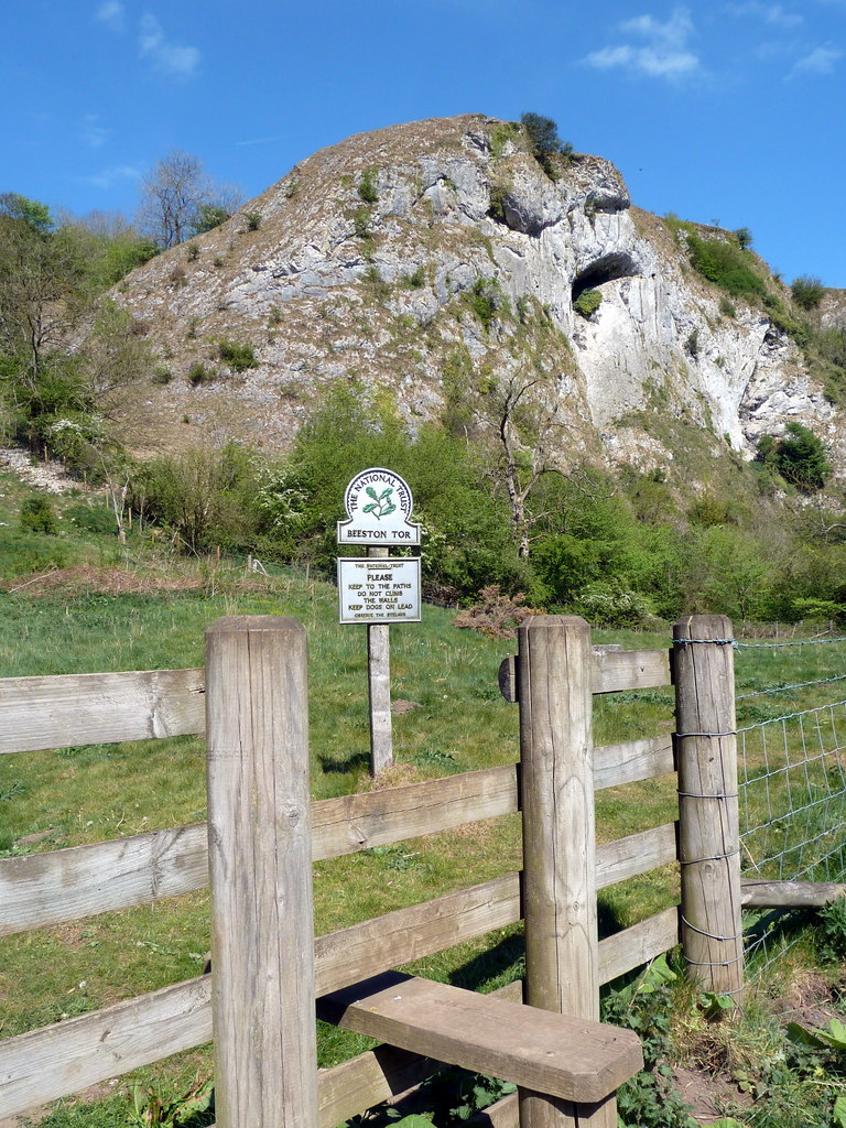
Beeston Tor on:
[Wikipedia]
[Google]
[Amazon]
 Beeston Tor () is a limestone cliff in
 Beeston Tor () is a limestone cliff in
 Staffordshire
Staffordshire (; postal abbreviation Staffs.) is a landlocked county in the West Midlands region of England. It borders Cheshire to the northwest, Derbyshire and Leicestershire to the east, Warwickshire to the southeast, the West Midlands Cou ...
. It overlooks the confluence of the River Hamps
The River Hamps is a river in Staffordshire, England. It is tributary of the River Manifold, which itself flows into the River Dove near Ilam. For much of its length the river flows through the Peak District National Park.
Etymology
The n ...
with the River Manifold
The River Manifold is a river in Staffordshire, England. It is a tributary of the River Dove (which also flows through the Peak District, forming the boundary between Derbyshire and Staffordshire).
The Manifold rises at Flash Head just sout ...
, and is a popular venue for rock climbing (seasonal restrictions for rock climbing apply).
There was a small station here, of the same name, opened by the narrow gauge (2' 6") Leek and Manifold Valley Light Railway
The Leek and Manifold Valley Light Railway (L&MVLR) was a narrow gauge railway in Staffordshire, England that operated between 1904 and 1934. The line mainly carried milk from dairies in the region, acting as a feeder to the system. It also ...
on 27 June 1904, whilst being entirely operated by the North Staffordshire Railway
The North Staffordshire Railway (NSR) was a British railway company formed in 1845 to promote a number of lines in the Staffordshire Potteries and surrounding areas in Staffordshire, Cheshire, Derbyshire and Shropshire.
The company was based i ...
. The station had no siding – unlike most of the stations on the line – but there was a refreshment room.
The line closed in 1934, and the route of the railway past the station is now designated the Manifold Way
The Manifold Way is a footpath and cycle way in Staffordshire, England. Some in length, it runs from Hulme End in the north to Waterhouses in the south, mostly through the Manifold Valley and the valley of its only tributary, the River Ham ...
, an 8-mile walk- and cycle-path which runs from Waterhouses to Hulme End
Hulme End () is a small hamlet in Staffordshire, England. It is located in the Peak District National Park about 10 miles north of Ashbourne. A natural gateway to the Manifold valley, the settlement is located beside the river Manifold where ...
.
References
Disused railway stations in Staffordshire Cliffs of England Landforms of Staffordshire {{England-rail-transport-stub